
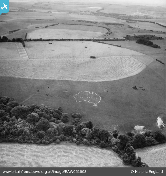
EAW051993 ENGLAND (1953). Chalk map of Australia on Compton Down, Compton Chamberlayne, 1953
© Copyright OpenStreetMap contributors and licensed by the OpenStreetMap Foundation. 2026. Cartography is licensed as CC BY-SA.
Nearby Images (4)
EAW051993

EAW031931

EAW051992

EAW031928

Details
| Title | [EAW051993] Chalk map of Australia on Compton Down, Compton Chamberlayne, 1953 |
| Reference | EAW051993 |
| Date | 5-September-1953 |
| Link | |
| Place name | COMPTON CHAMBERLAYNE |
| Parish | COMPTON CHAMBERLAYNE |
| District | |
| Country | ENGLAND |
| Easting / Northing | 404304, 129116 |
| Longitude / Latitude | -1.9385766571571, 51.06083166077 |
| National Grid Reference | SU043291 |
Pins
Be the first to add a comment to this image!