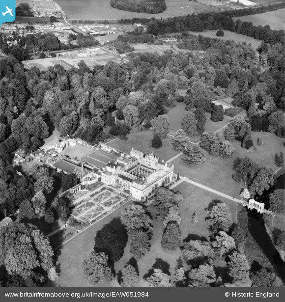
EAW051984 ENGLAND (1953). Wilton House, Wilton, 1953
© Copyright OpenStreetMap contributors and licensed by the OpenStreetMap Foundation. 2026. Cartography is licensed as CC BY-SA.
Nearby Images (6)
Details
| Title | [EAW051984] Wilton House, Wilton, 1953 |
| Reference | EAW051984 |
| Date | 5-September-1953 |
| Link | |
| Place name | WILTON |
| Parish | WILTON |
| District | |
| Country | ENGLAND |
| Easting / Northing | 410007, 131014 |
| Longitude / Latitude | -1.8571355277876, 51.077829544135 |
| National Grid Reference | SU100310 |
Pins
Be the first to add a comment to this image!


![[EAW051984] Wilton House, Wilton, 1953](http://britainfromabove.org.uk/sites/all/libraries/aerofilms-images/public/100x100/EAW/051/EAW051984.jpg)
![[EAW051983] Wilton House, Wilton, 1953](http://britainfromabove.org.uk/sites/all/libraries/aerofilms-images/public/100x100/EAW/051/EAW051983.jpg)
![[EPW033555] Wilton House, Wilton, 1930](http://britainfromabove.org.uk/sites/all/libraries/aerofilms-images/public/100x100/EPW/033/EPW033555.jpg)
![[EAW051981] Wilton House and environs, Wilton, 1953](http://britainfromabove.org.uk/sites/all/libraries/aerofilms-images/public/100x100/EAW/051/EAW051981.jpg)
![[EAW051985] Wilton House, Wilton, 1953](http://britainfromabove.org.uk/sites/all/libraries/aerofilms-images/public/100x100/EAW/051/EAW051985.jpg)
![[EAW051982] Wilton House and environs, Wilton, 1953](http://britainfromabove.org.uk/sites/all/libraries/aerofilms-images/public/100x100/EAW/051/EAW051982.jpg)