
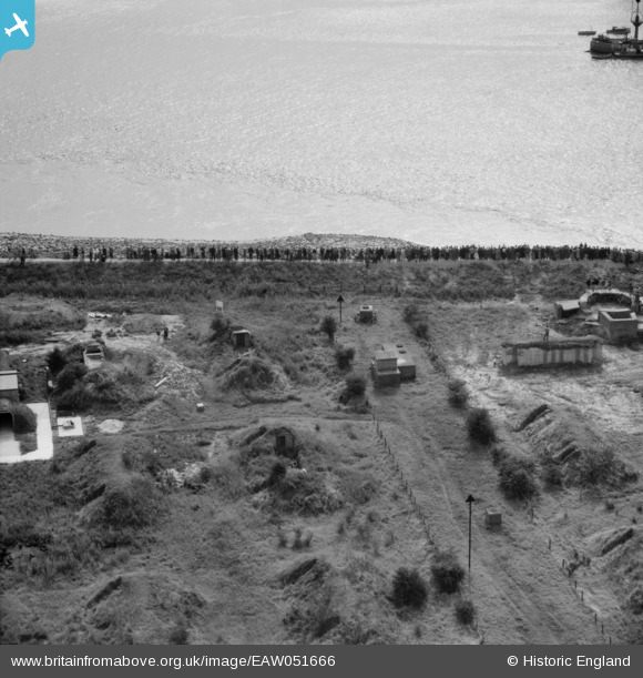
EAW051666 ENGLAND (1953). Brough, Crowds gathered at Brough Haven for the crossing of the River Humber by Lord Noel-Buxton, 1953
© Copyright OpenStreetMap contributors and licensed by the OpenStreetMap Foundation. 2026. Cartography is licensed as CC BY-SA.
Nearby Images (3)
EAW051666

EAW051668

EAW051669

Details
| Title | [EAW051666] Brough, Crowds gathered at Brough Haven for the crossing of the River Humber by Lord Noel-Buxton, 1953 |
| Reference | EAW051666 |
| Date | 27-August-1953 |
| Link | |
| Place name | BROUGH |
| Parish | ELLOUGHTON-CUM-BROUGH |
| District | |
| Country | ENGLAND |
| Easting / Northing | 493657, 426220 |
| Longitude / Latitude | -0.58040369278309, 53.723742303983 |
| National Grid Reference | SE937262 |
Pins

Matt Aldred edob.mattaldred.com |
Thursday 11th of January 2024 03:08:39 PM | |
|
Matt Aldred edob.mattaldred.com |
Thursday 11th of January 2024 03:08:06 PM | |

redmist |
Friday 11th of September 2020 07:09:50 PM | |
|
Al |
Tuesday 18th of November 2014 10:17:04 PM |