
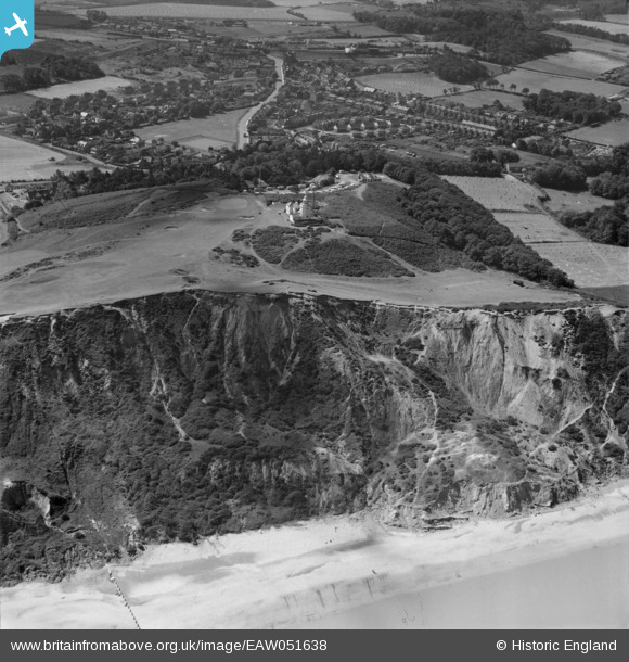
EAW051638 ENGLAND (1953). The coastal slope below Cromer Lighthouse and Happy Valley, Cromer, 1953
© Copyright OpenStreetMap contributors and licensed by the OpenStreetMap Foundation. 2026. Cartography is licensed as CC BY-SA.
Nearby Images (2)
EAW051638

EAW051637

Details
| Title | [EAW051638] The coastal slope below Cromer Lighthouse and Happy Valley, Cromer, 1953 |
| Reference | EAW051638 |
| Date | 26-August-1953 |
| Link | |
| Place name | CROMER |
| Parish | CROMER |
| District | |
| Country | ENGLAND |
| Easting / Northing | 623122, 341628 |
| Longitude / Latitude | 1.3198035331463, 52.92530740548 |
| National Grid Reference | TG231416 |
Pins

Matt Aldred edob.mattaldred.com |
Tuesday 7th of July 2026 05:02:06 PM | |

jimbo20 |
Wednesday 8th of March 2023 04:49:01 PM | |
|
John W |
Wednesday 22nd of March 2017 09:44:55 PM | |
This is Cromer High Station, not Cromer Links Halt. Cromer Links Halt was near the bridge over Northrepps Road |
jimbo20 |
Wednesday 8th of March 2023 04:52:32 PM |