
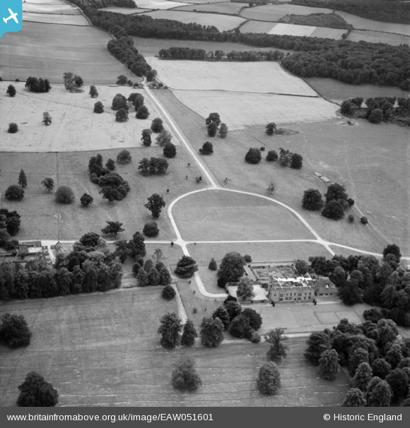
EAW051601 ENGLAND (1953). Chequers, Ellesborough, 1953
© Copyright OpenStreetMap contributors and licensed by the OpenStreetMap Foundation. 2025. Cartography is licensed as CC BY-SA.
Nearby Images (7)
EAW051601

EAW051602

EAW052738

EPR000039

EAW051606

EAW051603

EAW051604

Details
| Title | [EAW051601] Chequers, Ellesborough, 1953 |
| Reference | EAW051601 |
| Date | 26-August-1953 |
| Link | |
| Place name | ELLESBOROUGH |
| Parish | ELLESBOROUGH |
| District | |
| Country | ENGLAND |
| Easting / Northing | 484251, 205441 |
| Longitude / Latitude | -0.77964963054224, 51.740876554751 |
| National Grid Reference | SP843054 |
Pins
Be the first to add a comment to this image!