
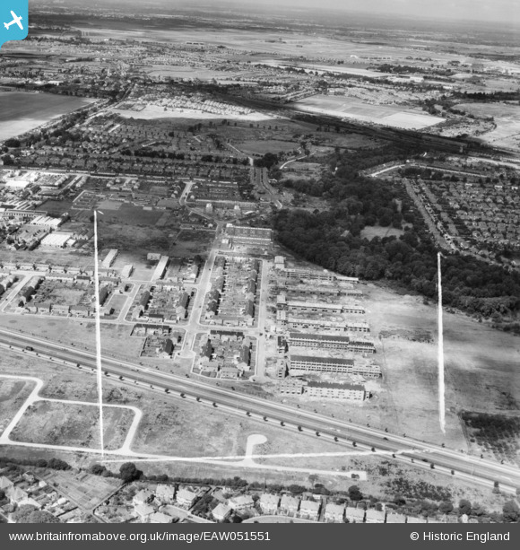
EAW051551 ENGLAND (1953). The Butts Farm Estate and environs, Hanworth, from the east, 1953. This image was marked by Aerofilms Ltd for photo editing.
© Copyright OpenStreetMap contributors and licensed by the OpenStreetMap Foundation. 2026. Cartography is licensed as CC BY-SA.
Nearby Images (2)
EAW051551

EAW051550

Details
| Title | [EAW051551] The Butts Farm Estate and environs, Hanworth, from the east, 1953. This image was marked by Aerofilms Ltd for photo editing. |
| Reference | EAW051551 |
| Date | 14-August-1953 |
| Link | |
| Place name | HANWORTH |
| Parish | |
| District | |
| Country | ENGLAND |
| Easting / Northing | 513224, 172461 |
| Longitude / Latitude | -0.37078681543021, 51.439323453608 |
| National Grid Reference | TQ132725 |
Pins
Be the first to add a comment to this image!