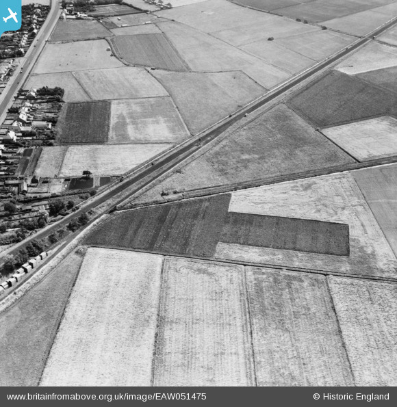
EAW051475 ENGLAND (1953). The Liverpool, Southport and Preston Junction Railway line near Meols View Farm, Pool Hey, 1953
© Copyright OpenStreetMap contributors and licensed by the OpenStreetMap Foundation. 2026. Cartography is licensed as CC BY-SA.
Details
| Title | [EAW051475] The Liverpool, Southport and Preston Junction Railway line near Meols View Farm, Pool Hey, 1953 |
| Reference | EAW051475 |
| Date | 12-August-1953 |
| Link | |
| Place name | POOL HEY |
| Parish | SCARISBRICK |
| District | |
| Country | ENGLAND |
| Easting / Northing | 335937, 415210 |
| Longitude / Latitude | -2.9688418908897, 53.629259609717 |
| National Grid Reference | SD359152 |
Pins

John Howard |
Thursday 22nd of October 2020 05:31:36 PM | |

Sparky |
Saturday 28th of October 2017 10:52:13 PM | |

Sparky |
Saturday 28th of October 2017 10:51:34 PM | |

wadey |
Saturday 6th of December 2014 10:40:37 PM | |

wadey |
Saturday 6th of December 2014 10:39:25 PM |


![[EAW051475] The Liverpool, Southport and Preston Junction Railway line near Meols View Farm, Pool Hey, 1953](http://britainfromabove.org.uk/sites/all/libraries/aerofilms-images/public/100x100/EAW/051/EAW051475.jpg)
![[EAW051477] Scarisbrick (Southport) Road and the Liverpool, Southport and Preston Junction Railway line near Meols View Farm, Southport, 1953](http://britainfromabove.org.uk/sites/all/libraries/aerofilms-images/public/100x100/EAW/051/EAW051477.jpg)
![[EAW051478] The Liverpool, Southport and Preston Junction Railway line near Kew Mill, Southport, 1953](http://britainfromabove.org.uk/sites/all/libraries/aerofilms-images/public/100x100/EAW/051/EAW051478.jpg)