
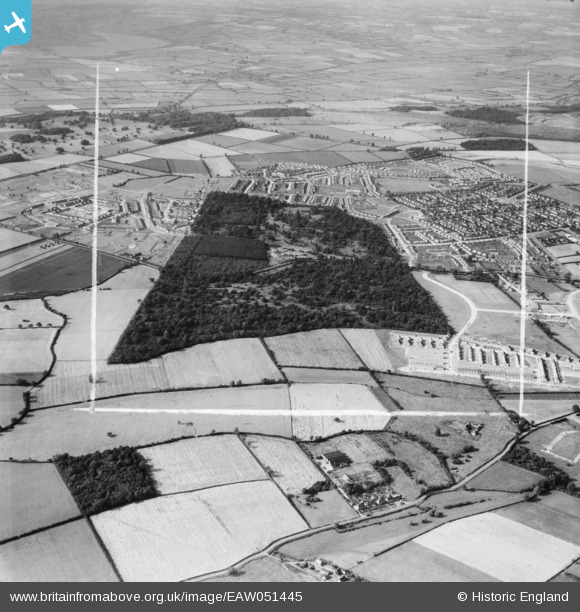
EAW051445 ENGLAND (1953). Housing development around Hazel and Thoroughsale Woods, Corby, 1953. This image was marked by Aerofilms Ltd for photo editing.
© Copyright OpenStreetMap contributors and licensed by the OpenStreetMap Foundation. 2026. Cartography is licensed as CC BY-SA.
Nearby Images (2)
EAW051445

EAW045571

Details
| Title | [EAW051445] Housing development around Hazel and Thoroughsale Woods, Corby, 1953. This image was marked by Aerofilms Ltd for photo editing. |
| Reference | EAW051445 |
| Date | 12-August-1953 |
| Link | |
| Place name | CORBY |
| Parish | |
| District | |
| Country | ENGLAND |
| Easting / Northing | 487593, 288654 |
| Longitude / Latitude | -0.70983632774893, 52.48839249611 |
| National Grid Reference | SP876887 |
Pins
Be the first to add a comment to this image!