
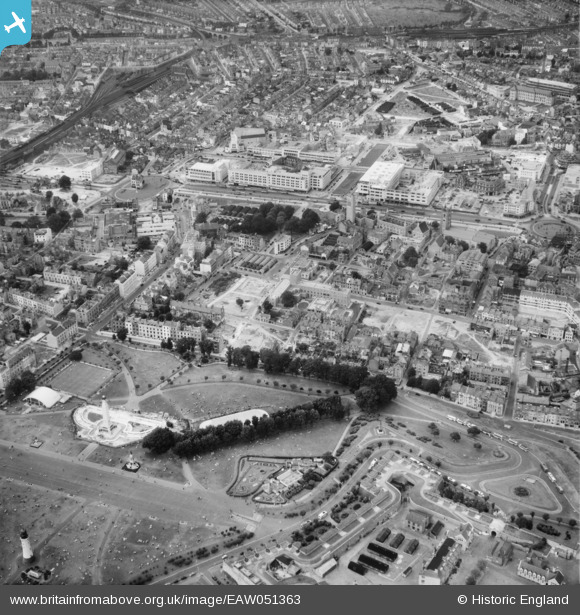
EAW051363 ENGLAND (1953). Hoe Park and the city centre, Plymouth, 1953
© Copyright OpenStreetMap contributors and licensed by the OpenStreetMap Foundation. 2026. Cartography is licensed as CC BY-SA.
Nearby Images (4)
EAW051363

EAW051364

EAW051365

EAW007572

Details
| Title | [EAW051363] Hoe Park and the city centre, Plymouth, 1953 |
| Reference | EAW051363 |
| Date | 11-August-1953 |
| Link | |
| Place name | PLYMOUTH |
| Parish | |
| District | |
| Country | ENGLAND |
| Easting / Northing | 247760, 54222 |
| Longitude / Latitude | -4.1409291912201, 50.367566809366 |
| National Grid Reference | SX478542 |
Pins

flyman |
Tuesday 5th of December 2023 09:03:19 PM | |
|
Wombateer |
Friday 12th of June 2020 08:42:32 PM | |
|
flyman |
Friday 14th of April 2017 11:15:00 PM | |
|
flyman |
Friday 14th of April 2017 11:14:55 PM |