
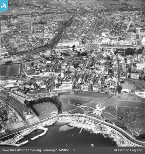
EAW051362 ENGLAND (1953). West Hoe Park, The Hoe and the city centre, Plymouth, 1953
© Copyright OpenStreetMap contributors and licensed by the OpenStreetMap Foundation. 2026. Cartography is licensed as CC BY-SA.
Nearby Images (4)
EAW051362

EAW051364

EPW011266

EPW054896

Details
| Title | [EAW051362] West Hoe Park, The Hoe and the city centre, Plymouth, 1953 |
| Reference | EAW051362 |
| Date | 11-August-1953 |
| Link | |
| Place name | PLYMOUTH |
| Parish | |
| District | |
| Country | ENGLAND |
| Easting / Northing | 247459, 54067 |
| Longitude / Latitude | -4.1450961291032, 50.366095709923 |
| National Grid Reference | SX475541 |
Pins

Alan Baker |
Thursday 25th of July 2024 01:15:35 PM | |
|
Alan Baker |
Thursday 25th of July 2024 01:14:47 PM | |
|
Alan Baker |
Thursday 25th of July 2024 01:14:26 PM | |
|
Alan Baker |
Thursday 25th of July 2024 01:13:58 PM | |
|
AndyM |
Wednesday 12th of August 2020 07:01:33 PM | |
|
AndyM |
Wednesday 12th of August 2020 07:00:41 PM | |
|
AndyM |
Wednesday 12th of August 2020 06:59:48 PM | |
|
Post-war prefabs |
Saturday 9th of November 2019 08:18:45 AM | |

Sparky |
Saturday 28th of October 2017 05:34:46 PM | |
|
flyman |
Friday 28th of July 2017 08:29:13 PM |