
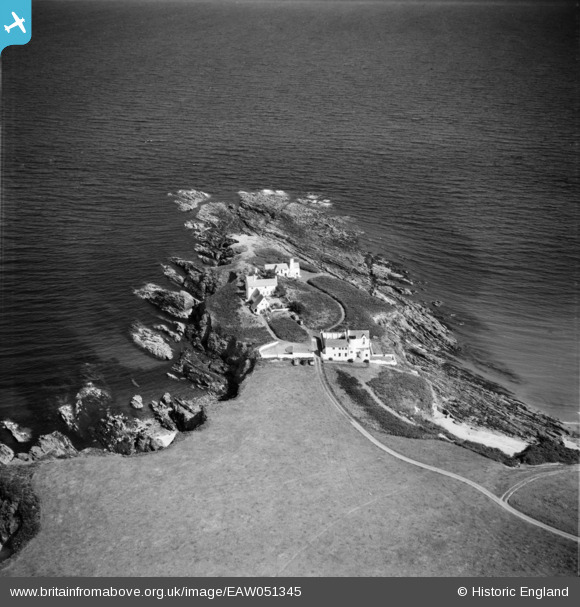
EAW051345 ENGLAND (1953). Chapel Point, Portmellon, 1953
© Copyright OpenStreetMap contributors and licensed by the OpenStreetMap Foundation. 2026. Cartography is licensed as CC BY-SA.
Nearby Images (2)
EAW051345

EAW051344

Details
| Title | [EAW051345] Chapel Point, Portmellon, 1953 |
| Reference | EAW051345 |
| Date | 11-August-1953 |
| Link | |
| Place name | PORTMELLON |
| Parish | MEVAGISSEY |
| District | |
| Country | ENGLAND |
| Easting / Northing | 202729, 43298 |
| Longitude / Latitude | -4.7677890305502, 50.256055262744 |
| National Grid Reference | SX027433 |
Pins
Be the first to add a comment to this image!