
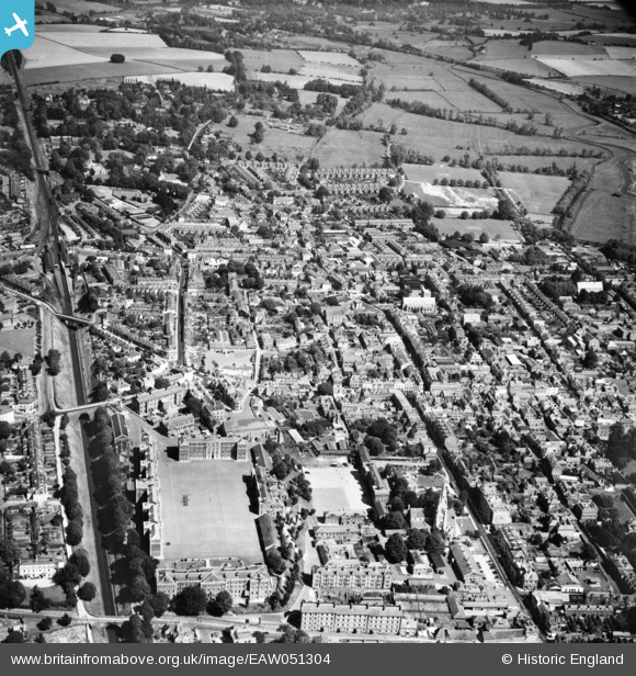
EAW051304 ENGLAND (1953). Winchester Barracks and the city centre, Winchester, 1953
© Copyright OpenStreetMap contributors and licensed by the OpenStreetMap Foundation. 2026. Cartography is licensed as CC BY-SA.
Nearby Images (7)
EAW051304

EAW022309

EAW051301

EPW016869

EAW022269

EAW051298

EPW023323

Details
| Title | [EAW051304] Winchester Barracks and the city centre, Winchester, 1953 |
| Reference | EAW051304 |
| Date | 8-August-1953 |
| Link | |
| Place name | WINCHESTER |
| Parish | |
| District | |
| Country | ENGLAND |
| Easting / Northing | 447956, 129702 |
| Longitude / Latitude | -1.3155574655182, 51.06411404278 |
| National Grid Reference | SU480297 |
Pins

highsidedvehicles |
Tuesday 2nd of April 2019 06:55:39 PM | |
|
highsidedvehicles |
Tuesday 2nd of April 2019 06:49:31 PM | |
|
highsidedvehicles |
Tuesday 2nd of April 2019 06:48:27 PM | |
|
highsidedvehicles |
Tuesday 2nd of April 2019 06:47:20 PM | |
|
highsidedvehicles |
Tuesday 2nd of April 2019 06:46:15 PM | |
|
Peter |
Friday 20th of March 2015 08:21:08 PM | |
|
Peter |
Friday 20th of March 2015 08:20:07 PM |