
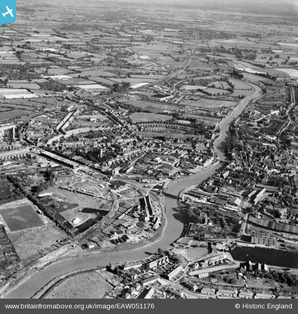
EAW051176 ENGLAND (1953). The River Parrett and the town, Bridgwater, 1953
© Copyright OpenStreetMap contributors and licensed by the OpenStreetMap Foundation. 2026. Cartography is licensed as CC BY-SA.
Nearby Images (5)
EAW051176

EAW051175

EAW051173

EAW051174

EPW027940

Details
| Title | [EAW051176] The River Parrett and the town, Bridgwater, 1953 |
| Reference | EAW051176 |
| Date | 6-August-1953 |
| Link | |
| Place name | BRIDGWATER |
| Parish | BRIDGWATER |
| District | |
| Country | ENGLAND |
| Easting / Northing | 330256, 137166 |
| Longitude / Latitude | -2.9968071682235, 51.128994459691 |
| National Grid Reference | ST303372 |
Pins

Peter Randle |
Friday 28th of March 2025 12:03:24 PM | |

Dylan Moore |
Thursday 18th of January 2018 03:53:48 PM | |
|
gBr |
Tuesday 17th of November 2015 09:30:49 PM | |
|
gBr |
Tuesday 17th of November 2015 09:28:41 PM | |
|
gBr |
Tuesday 17th of November 2015 09:12:18 PM | |
|
gBr |
Tuesday 17th of November 2015 09:09:32 PM | |
|
gBr |
Tuesday 17th of November 2015 09:08:28 PM | |
|
gBr |
Tuesday 17th of November 2015 08:28:06 PM | |
|
cptpies |
Friday 21st of November 2014 09:21:18 AM |