
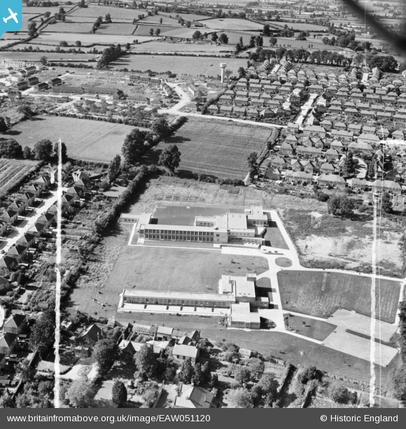
EAW051120 ENGLAND (1953). The Yeovil Westfield County Junior School and Infant School and the surrounding residential area, Yeovil, 1953. This image was marked by Aerofilms Ltd for photo editing.
© Copyright OpenStreetMap contributors and licensed by the OpenStreetMap Foundation. 2026. Cartography is licensed as CC BY-SA.
Nearby Images (9)
EAW051120

EAW051126

EAW051125

EAW051122

EAW051123

EAW051119

EAW051118

EAW051124

EAW051121

Details
| Title | [EAW051120] The Yeovil Westfield County Junior School and Infant School and the surrounding residential area, Yeovil, 1953. This image was marked by Aerofilms Ltd for photo editing. |
| Reference | EAW051120 |
| Date | 10-August-1953 |
| Link | |
| Place name | YEOVIL |
| Parish | YEOVIL |
| District | |
| Country | ENGLAND |
| Easting / Northing | 354406, 116821 |
| Longitude / Latitude | -2.6491150132101, 50.948471747152 |
| National Grid Reference | ST544168 |
Pins
Be the first to add a comment to this image!