
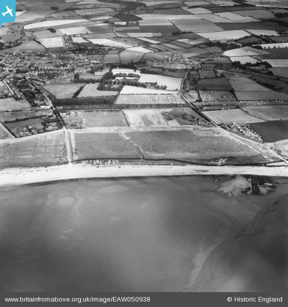
EAW050938 ENGLAND (1953). Stubborn Sand and adjacent Caravan Parks, Heacham, 1953
© Copyright OpenStreetMap contributors and licensed by the OpenStreetMap Foundation. 2026. Cartography is licensed as CC BY-SA.
Nearby Images (2)
EAW050938

EAW050971

Details
| Title | [EAW050938] Stubborn Sand and adjacent Caravan Parks, Heacham, 1953 |
| Reference | EAW050938 |
| Date | 30-July-1953 |
| Link | |
| Place name | HEACHAM |
| Parish | HEACHAM |
| District | |
| Country | ENGLAND |
| Easting / Northing | 566455, 337233 |
| Longitude / Latitude | 0.47541514450558, 52.906390543206 |
| National Grid Reference | TF665372 |
Pins

Matt Aldred edob.mattaldred.com |
Monday 2nd of September 2019 04:16:08 PM | |
|
Matt Aldred edob.mattaldred.com |
Monday 2nd of September 2019 04:15:41 PM | |

Cool dude |
Sunday 22nd of November 2015 03:03:31 PM | |
|
Cool dude |
Sunday 22nd of November 2015 03:02:00 PM |