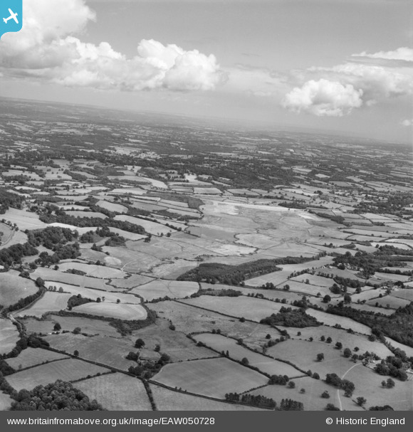
EAW050728 ENGLAND (1953). Weir Wood Reservoir under construction, Forest Row, from the south-west, 1953
© Copyright OpenStreetMap contributors and licensed by the OpenStreetMap Foundation. 2026. Cartography is licensed as CC BY-SA.
Details
| Title | [EAW050728] Weir Wood Reservoir under construction, Forest Row, from the south-west, 1953 |
| Reference | EAW050728 |
| Date | 15-July-1953 |
| Link | |
| Place name | FOREST ROW |
| Parish | FOREST ROW |
| District | |
| Country | ENGLAND |
| Easting / Northing | 538498, 134311 |
| Longitude / Latitude | -0.022103049240412, 51.090835429018 |
| National Grid Reference | TQ385343 |
Pins

M Anton |
Wednesday 6th of March 2019 10:03:36 AM | |

M Anton |
Wednesday 6th of March 2019 10:01:23 AM | |

Class31 |
Saturday 28th of May 2016 08:06:33 AM |
User Comment Contributions
View from Standen House, East Grinstead, 26/05/2016 |

Class31 |
Saturday 28th of May 2016 08:11:16 AM |


![[EAW050728] Weir Wood Reservoir under construction, Forest Row, from the south-west, 1953](http://britainfromabove.org.uk/sites/all/libraries/aerofilms-images/public/100x100/EAW/050/EAW050728.jpg)
![[EAW050726] Weir Wood Reservoir under construction, Forest Row, from the south-west, 1953](http://britainfromabove.org.uk/sites/all/libraries/aerofilms-images/public/100x100/EAW/050/EAW050726.jpg)