
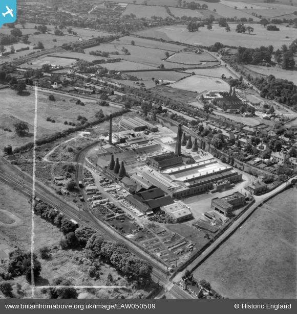
EAW050509 ENGLAND (1953). The Taylor Tunnicliff Electrical Porcelain Factory, Stone, 1953. This image was marked by Aerofilms Ltd for photo editing.
© Copyright OpenStreetMap contributors and licensed by the OpenStreetMap Foundation. 2026. Cartography is licensed as CC BY-SA.
Nearby Images (17)
EAW050509

EAW050517

EAW050511

EPW047680

EAW050512

EAW050513

EPW020070

EAW050515

EAW050508

EPW026980

EAW050514

EAW050510

EAW050516

EPW020069

EPW026983

EPW053343

EPW053345

Details
| Title | [EAW050509] The Taylor Tunnicliff Electrical Porcelain Factory, Stone, 1953. This image was marked by Aerofilms Ltd for photo editing. |
| Reference | EAW050509 |
| Date | 7-July-1953 |
| Link | |
| Place name | STONE |
| Parish | STONE |
| District | |
| Country | ENGLAND |
| Easting / Northing | 389464, 334603 |
| Longitude / Latitude | -2.1566790106573, 52.908435447455 |
| National Grid Reference | SJ895346 |
Pins

rj44fa |
Sunday 1st of November 2015 11:49:03 AM |