
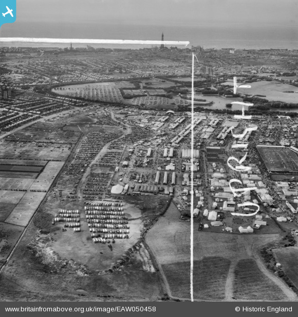
EAW050458 ENGLAND (1953). Blackpool, The Royal Agricultural Society of England Show, from the east, 1953. This image was marked by Aerofilms Ltd for photo editing.
© Copyright OpenStreetMap contributors and licensed by the OpenStreetMap Foundation. 2026. Cartography is licensed as CC BY-SA.
Nearby Images (3)
EAW050458

EAW050460

EAW050603

Details
| Title | [EAW050458] Blackpool, The Royal Agricultural Society of England Show, from the east, 1953. This image was marked by Aerofilms Ltd for photo editing. |
| Reference | EAW050458 |
| Date | 8-July-1953 |
| Link | |
| Place name | BLACKPOOL |
| Parish | |
| District | |
| Country | ENGLAND |
| Easting / Northing | 333948, 435456 |
| Longitude / Latitude | -3.0032387063544, 53.810978535932 |
| National Grid Reference | SD339355 |
Pins

Matt Aldred edob.mattaldred.com |
Saturday 15th of May 2021 05:43:31 PM |