
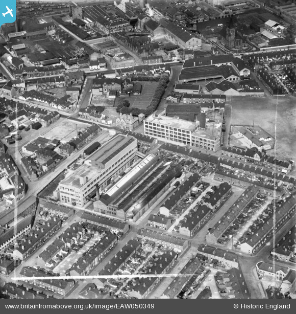
EAW050349 ENGLAND (1953). The Alliance Box Co Ltd Works on Orford Lane and environs, Warrington, 1953. This image was marked by Aerofilms Ltd for photo editing.
© Copyright OpenStreetMap contributors and licensed by the OpenStreetMap Foundation. 2026. Cartography is licensed as CC BY-SA.
Nearby Images (19)
EAW050349

EAW014616

EAW050348

EAW014619

EAW050347

EAW014618

EAW014615

EAW014617

EAW050345

EAW014612

EAW050352

EAW014613

EAW050351

EAW014614

EAW050350

EAW014621

EAW050346

EAW014622

EAW014620

Details
| Title | [EAW050349] The Alliance Box Co Ltd Works on Orford Lane and environs, Warrington, 1953. This image was marked by Aerofilms Ltd for photo editing. |
| Reference | EAW050349 |
| Date | 3-July-1953 |
| Link | |
| Place name | WARRINGTON |
| Parish | |
| District | |
| Country | ENGLAND |
| Easting / Northing | 360772, 388915 |
| Longitude / Latitude | -2.5899923186689, 53.395345332692 |
| National Grid Reference | SJ608889 |
