
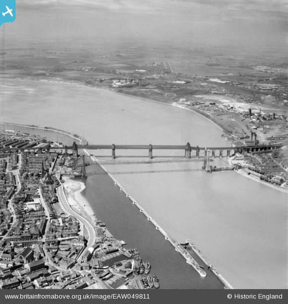
EAW049811 ENGLAND (1953). The Widnes Transporter Bridge and Runcorn Railway Bridge crossing the River Mersey and Manchester Ship Canal, Runcorn Gap, from the south-east, 1953
© Copyright OpenStreetMap contributors and licensed by the OpenStreetMap Foundation. 2026. Cartography is licensed as CC BY-SA.
Nearby Images (7)
EAW049811

EAW049810

EAW044939

EAW049800

EAW049813

EPW018913

EAW008430

Details
| Title | [EAW049811] The Widnes Transporter Bridge and Runcorn Railway Bridge crossing the River Mersey and Manchester Ship Canal, Runcorn Gap, from the south-east, 1953 |
| Reference | EAW049811 |
| Date | 30-May-1953 |
| Link | |
| Place name | RUNCORN GAP |
| Parish | |
| District | |
| Country | ENGLAND |
| Easting / Northing | 351278, 383343 |
| Longitude / Latitude | -2.731912237481, 53.344468191351 |
| National Grid Reference | SJ513833 |
Pins

Bottom Yard |
Monday 12th of May 2025 05:18:03 PM | |
|
Bottom Yard |
Monday 12th of May 2025 05:13:14 PM | |
|
Bottom Yard |
Monday 12th of May 2025 05:11:28 PM | |
|
Bottom Yard |
Tuesday 12th of November 2024 01:44:22 PM | |
|
Bottom Yard |
Tuesday 12th of November 2024 01:30:22 PM | |
|
Bottom Yard |
Tuesday 12th of November 2024 01:24:14 PM | |
|
redmist |
Thursday 28th of March 2019 09:53:17 AM | |
|
redmist |
Thursday 28th of March 2019 09:51:35 AM | |
|
redmist |
Thursday 28th of March 2019 09:49:19 AM | |
|
redmist |
Thursday 28th of March 2019 09:48:37 AM | |
|
redmist |
Thursday 28th of March 2019 09:47:51 AM |