
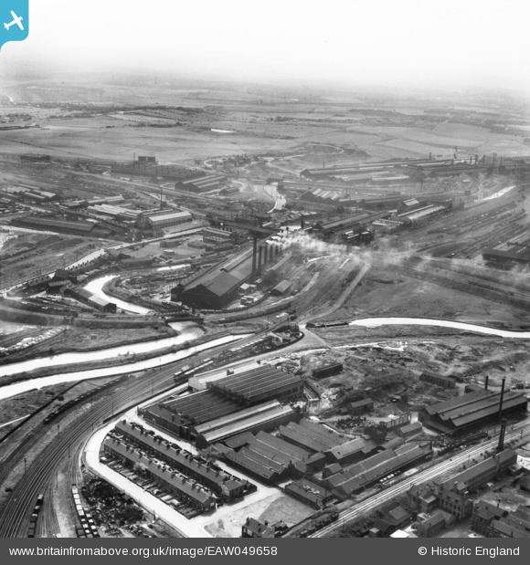
EAW049658 ENGLAND (1953). The industrial landscape of New York, Ickles and Templeborough, Rotherham, from the north-east, 1953
© Copyright OpenStreetMap contributors and licensed by the OpenStreetMap Foundation. 2026. Cartography is licensed as CC BY-SA.
Nearby Images (18)
EAW049658

EAW048632

EAW048649

EAW049661

EAW049662

EAW048631

EAW049657

EAW049660

EAW048634

EAW048633

EAW048629

EAW048635

EAW048637

EAW048636

EAW048630

EAW048638

EAW049659

EAW024146

Details
| Title | [EAW049658] The industrial landscape of New York, Ickles and Templeborough, Rotherham, from the north-east, 1953 |
| Reference | EAW049658 |
| Date | 24-May-1953 |
| Link | |
| Place name | ROTHERHAM |
| Parish | |
| District | |
| Country | ENGLAND |
| Easting / Northing | 442180, 392386 |
| Longitude / Latitude | -1.3651478130443, 53.426318689718 |
| National Grid Reference | SK422924 |
