
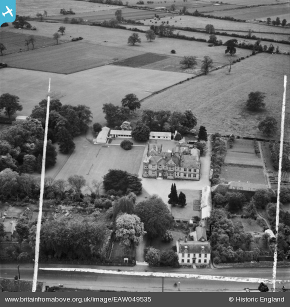
EAW049535 ENGLAND (1953). The Soham Grammar School (Beechurst House), Soham, 1953. This image was marked by Aerofilms Ltd for photo editing.
© Copyright OpenStreetMap contributors and licensed by the OpenStreetMap Foundation. 2026. Cartography is licensed as CC BY-SA.
Nearby Images (9)
EAW049535
, Soham, 1953. This image was marked by Aerofilms Ltd for photo editing.")
EAW049534
 and environs, Soham, 1953. This image was marked by Aerofilms Ltd for photo editing.")
EAW049536
 and Soham Mere, Soham, from the east, 1953. This image was marked by Aerofilms Ltd for photo editing.")
EAW049533
 and environs, Soham, 1953. This image was marked by Aerofilms Ltd for photo editing.")
EAW049538
 and environs, Soham, 1953. This image was marked by Aerofilms Ltd for photo editing.")
EAW049532
 and the town centre, Soham, 1953. This image was marked by Aerofilms Ltd for photo editing.")
EAW049539
 and the town, Soham, 1953. This image was marked by Aerofilms Ltd for photo editing.")
EAW049540
 and Soham Mere, Soham, from the east, 1953. This image was marked by Aerofilms Ltd for photo editing.")
EAW049537
 and the town, Soham, 1953. This image was marked by Aerofilms Ltd for photo editing.")
Details
| Title | [EAW049535] The Soham Grammar School (Beechurst House), Soham, 1953. This image was marked by Aerofilms Ltd for photo editing. |
| Reference | EAW049535 |
| Date | 19-May-1953 |
| Link | |
| Place name | SOHAM |
| Parish | SOHAM |
| District | |
| Country | ENGLAND |
| Easting / Northing | 559501, 272686 |
| Longitude / Latitude | 0.34094449409426, 52.328661726422 |
| National Grid Reference | TL595727 |
Pins

pf329 |
Sunday 14th of June 2015 04:36:44 PM |