
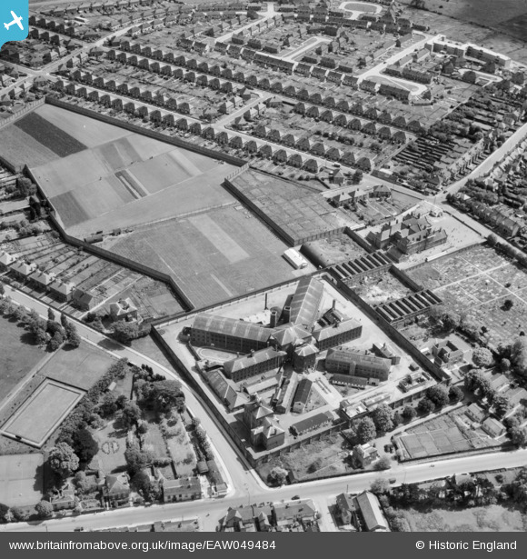
EAW049484 ENGLAND (1953). HMP Chelmsford, Chelmsford, 1953
© Copyright OpenStreetMap contributors and licensed by the OpenStreetMap Foundation. 2026. Cartography is licensed as CC BY-SA.
Nearby Images (5)
EAW049484

EAW001533

EAW049485

EAW049474

EAW050572

Details
| Title | [EAW049484] HMP Chelmsford, Chelmsford, 1953 |
| Reference | EAW049484 |
| Date | 19-May-1953 |
| Link | |
| Place name | CHELMSFORD |
| Parish | |
| District | |
| Country | ENGLAND |
| Easting / Northing | 571759, 207034 |
| Longitude / Latitude | 0.48770373534315, 51.735203306615 |
| National Grid Reference | TL718070 |
Pins

Doug |
Wednesday 11th of June 2014 09:12:07 PM | |
|
Doug |
Wednesday 11th of June 2014 09:10:54 PM | |
|
Doug |
Wednesday 11th of June 2014 09:09:50 PM | |
|
Doug |
Wednesday 11th of June 2014 09:08:58 PM | |
|
Doug |
Wednesday 11th of June 2014 09:08:07 PM | |
|
Doug |
Wednesday 11th of June 2014 09:06:13 PM | |
|
Doug |
Wednesday 11th of June 2014 09:05:22 PM | |
|
Doug |
Wednesday 11th of June 2014 09:04:05 PM | |
|
Doug |
Wednesday 11th of June 2014 09:03:20 PM | |
|
Doug |
Wednesday 11th of June 2014 09:02:42 PM | |
|
Doug |
Wednesday 11th of June 2014 09:01:56 PM | |
|
Doug |
Wednesday 11th of June 2014 09:01:11 PM | |
|
Doug |
Wednesday 11th of June 2014 09:00:38 PM | |
|
Doug |
Wednesday 11th of June 2014 08:57:54 PM | |
|
Doug |
Wednesday 11th of June 2014 08:57:25 PM | |
|
Doug |
Wednesday 11th of June 2014 08:56:46 PM | |
|
Doug |
Wednesday 11th of June 2014 08:56:22 PM | |
USED TO BE CALLED GAOL LANE |
Ian |
Thursday 28th of July 2016 08:55:54 PM |