
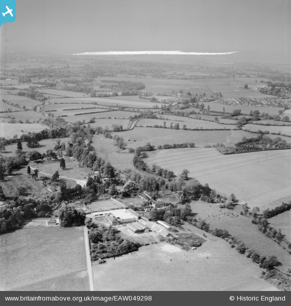
EAW049298 ENGLAND (1953). Arborfield Hall and Farm and environs, Arborfield, from the north-east, 1953. This image was marked by Aerofilms Ltd for photo editing.
© Copyright OpenStreetMap contributors and licensed by the OpenStreetMap Foundation. 2026. Cartography is licensed as CC BY-SA.
Nearby Images (3)
EAW049298

EAW049299

EAW049300

Details
| Title | [EAW049298] Arborfield Hall and Farm and environs, Arborfield, from the north-east, 1953. This image was marked by Aerofilms Ltd for photo editing. |
| Reference | EAW049298 |
| Date | 13-May-1953 |
| Link | |
| Place name | ARBORFIELD |
| Parish | ARBORFIELD AND NEWLAND |
| District | |
| Country | ENGLAND |
| Easting / Northing | 474942, 168194 |
| Longitude / Latitude | -0.92240884911877, 51.407319217442 |
| National Grid Reference | SU749682 |
Pins
Be the first to add a comment to this image!