
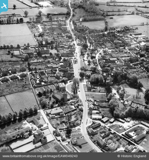
EAW049243 ENGLAND (1953). The village, Bourton-on-the-Water, 1953
© Copyright OpenStreetMap contributors and licensed by the OpenStreetMap Foundation. 2026. Cartography is licensed as CC BY-SA.
Nearby Images (9)
EAW049243

EAW020810

EAW049244

EAW020811

EAW049242

EAW020809

EAW020812

EAW020808

EAW020813

Details
| Title | [EAW049243] The village, Bourton-on-the-Water, 1953 |
| Reference | EAW049243 |
| Date | 12-May-1953 |
| Link | |
| Place name | BOURTON-ON-THE-WATER |
| Parish | BOURTON-ON-THE-WATER |
| District | |
| Country | ENGLAND |
| Easting / Northing | 416735, 220767 |
| Longitude / Latitude | -1.7568294297663, 51.884772667374 |
| National Grid Reference | SP167208 |


