
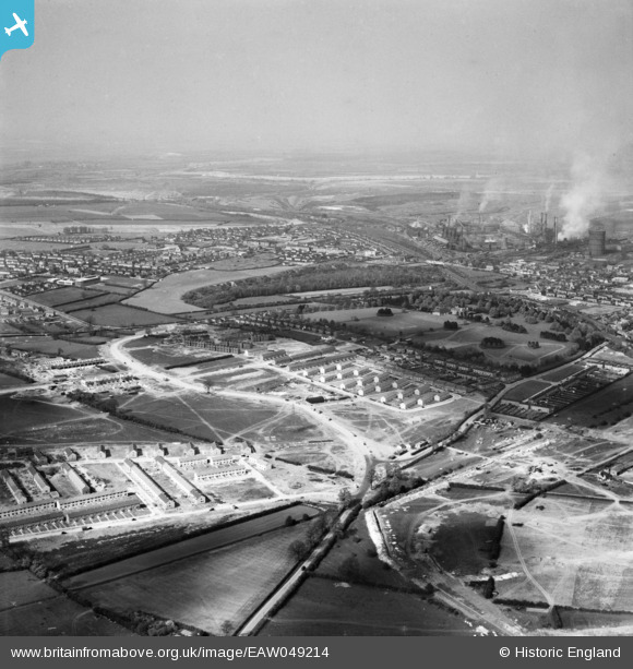
EAW049214 ENGLAND (1953). New housing developments surrounding Elizabeth Street, Corby, from the south, 1953
© Copyright OpenStreetMap contributors and licensed by the OpenStreetMap Foundation. 2026. Cartography is licensed as CC BY-SA.
Nearby Images (2)
EAW049214

EAW049213

Details
| Title | [EAW049214] New housing developments surrounding Elizabeth Street, Corby, from the south, 1953 |
| Reference | EAW049214 |
| Date | 11-May-1953 |
| Link | |
| Place name | CORBY |
| Parish | |
| District | |
| Country | ENGLAND |
| Easting / Northing | 488416, 288174 |
| Longitude / Latitude | -0.69784512441773, 52.483945154433 |
| National Grid Reference | SP884882 |
Pins

Michael Mahon |
Friday 9th of October 2015 08:01:54 PM | |
|
Michael Mahon |
Friday 9th of October 2015 08:00:25 PM |