
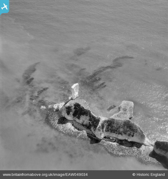
EAW049034 ENGLAND (1953). Old Harry Rocks, Studland, 1953
© Copyright OpenStreetMap contributors and licensed by the OpenStreetMap Foundation. 2026. Cartography is licensed as CC BY-SA.
Nearby Images (3)
EAW049034

EAW049033

EAW049032

Details
| Title | [EAW049034] Old Harry Rocks, Studland, 1953 |
| Reference | EAW049034 |
| Date | 4-May-1953 |
| Link | |
| Place name | STUDLAND |
| Parish | STUDLAND |
| District | |
| Country | ENGLAND |
| Easting / Northing | 405587, 82527 |
| Longitude / Latitude | -1.9209778385764, 50.641822541821 |
| National Grid Reference | SZ056825 |
Pins
Be the first to add a comment to this image!
User Comment Contributions
Old Harry Rocks, Studland, 01/03/2015 |

Class31 |
Monday 2nd of March 2015 11:06:26 AM |