
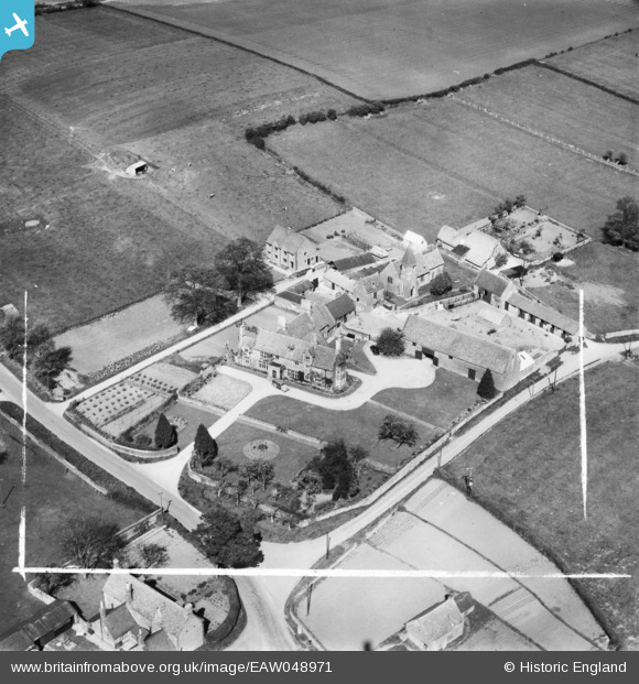
EAW048971 ENGLAND (1953). The Manor House, St John's Church and environs, Barford St John, 1953. This image was marked by Aerofilms Ltd for photo editing.
© Copyright OpenStreetMap contributors and licensed by the OpenStreetMap Foundation. 2026. Cartography is licensed as CC BY-SA.
Nearby Images (6)
EAW048971

EAW048969

EAW048974

EAW048972

EAW048970

EAW048973

Details
| Title | [EAW048971] The Manor House, St John's Church and environs, Barford St John, 1953. This image was marked by Aerofilms Ltd for photo editing. |
| Reference | EAW048971 |
| Date | 5-May-1953 |
| Link | |
| Place name | BARFORD ST JOHN |
| Parish | BARFORD ST. JOHN AND ST. MICHAEL |
| District | |
| Country | ENGLAND |
| Easting / Northing | 443849, 233198 |
| Longitude / Latitude | -1.361277966237, 51.995069650349 |
| National Grid Reference | SP438332 |
Pins
Be the first to add a comment to this image!