
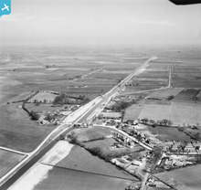
EAW048851 ENGLAND (1953). Forty Foot Bridge and the Forty Foot Drain, Ramsey Forty Foot, from the west, 1953

© Copyright OpenStreetMap contributors and licensed by the OpenStreetMap Foundation. 2026. Cartography is licensed as CC BY-SA.
Details
| Title | [EAW048851] Forty Foot Bridge and the Forty Foot Drain, Ramsey Forty Foot, from the west, 1953 |
| Reference | EAW048851 |
| Date | 23-April-1953 |
| Link | |
| Place name | RAMSEY FORTY FOOT |
| Parish | RAMSEY |
| District | |
| Country | ENGLAND |
| Easting / Northing | 530613, 287951 |
| Longitude / Latitude | -0.076791293560958, 52.473472446784 |
| National Grid Reference | TL306880 |
Pins
User Comment Contributions
Eastern Command Pillbox S0004790 |

cptpies |
Tuesday 17th of June 2014 12:18:15 PM |