
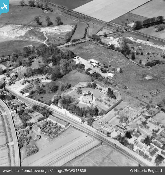
EAW048838 ENGLAND (1953). The Fort on Sicklesmere Road, Bury St Edmunds, 1953
© Copyright OpenStreetMap contributors and licensed by the OpenStreetMap Foundation. 2026. Cartography is licensed as CC BY-SA.
Nearby Images (2)
EAW048838

EAW048837

Details
| Title | [EAW048838] The Fort on Sicklesmere Road, Bury St Edmunds, 1953 |
| Reference | EAW048838 |
| Date | 23-April-1953 |
| Link | |
| Place name | BURY ST EDMUNDS |
| Parish | BURY ST. EDMUNDS |
| District | |
| Country | ENGLAND |
| Easting / Northing | 586377, 263137 |
| Longitude / Latitude | 0.72966456975747, 52.234432065607 |
| National Grid Reference | TL864631 |
Pins

Matt Aldred edob.mattaldred.com |
Tuesday 7th of May 2019 04:25:35 PM | |

cptpies |
Friday 8th of February 2019 02:42:25 PM |