
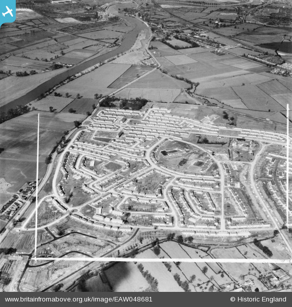
EAW048681 ENGLAND (1953). Council estate under construction, Clifton, 1953. This image was marked by Aerofilms Ltd for photo editing.
© Copyright OpenStreetMap contributors and licensed by the OpenStreetMap Foundation. 2026. Cartography is licensed as CC BY-SA.
Nearby Images (10)
EAW048681

EAW048684

EAW048686

EAW048680

EAW048687

EAW048685

EAW048682

EAW048679

EAW038704

EAW038703

Details
| Title | [EAW048681] Council estate under construction, Clifton, 1953. This image was marked by Aerofilms Ltd for photo editing. |
| Reference | EAW048681 |
| Date | 3-May-1953 |
| Link | |
| Place name | CLIFTON |
| Parish | |
| District | |
| Country | ENGLAND |
| Easting / Northing | 455547, 335316 |
| Longitude / Latitude | -1.1738935156834, 52.912076911079 |
| National Grid Reference | SK555353 |
Pins

KC |
Friday 28th of June 2024 02:58:18 PM | |
|
KC |
Friday 28th of June 2024 02:57:55 PM | |
|
KC |
Friday 28th of June 2024 02:57:32 PM | |
|
KC |
Friday 28th of June 2024 02:57:08 PM | |
|
KC |
Monday 12th of June 2023 12:10:21 PM | |
|
james |
Monday 12th of December 2016 07:17:35 PM |