
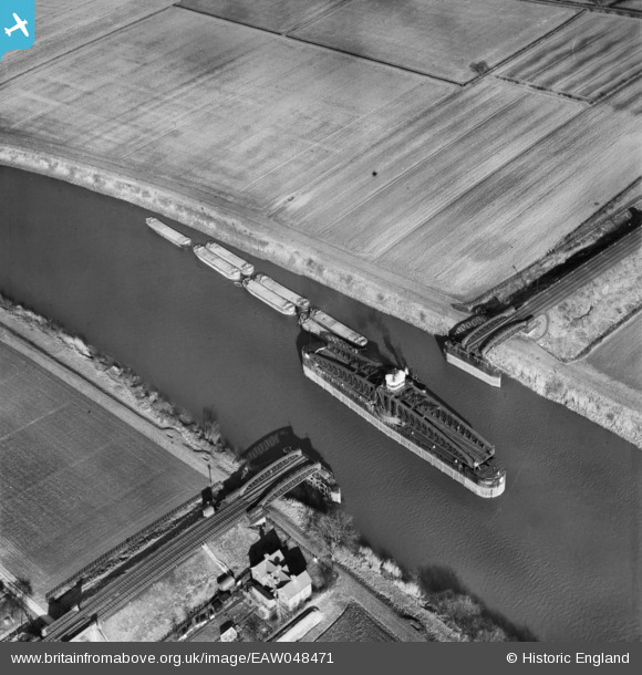
EAW048471 ENGLAND (1953). Ouse Swing Bridge, Barmby on the Marsh, 1953
© Copyright OpenStreetMap contributors and licensed by the OpenStreetMap Foundation. 2026. Cartography is licensed as CC BY-SA.
Nearby Images (3)
EAW048471

EAW048469

EAW048470

Details
| Title | [EAW048471] Ouse Swing Bridge, Barmby on the Marsh, 1953 |
| Reference | EAW048471 |
| Date | 24-February-1953 |
| Link | |
| Place name | BARMBY ON THE MARSH |
| Parish | BARMBY ON THE MARSH |
| District | |
| Country | ENGLAND |
| Easting / Northing | 468554, 428106 |
| Longitude / Latitude | -0.9604001202104, 53.744596137047 |
| National Grid Reference | SE686281 |
Pins
Be the first to add a comment to this image!
User Comment Contributions
This is the Hull & Barnsley Railway Swing Bridge at Long Drax. http://en.wikipedia.org/wiki/Long_Drax_swing_bridge |

Brightonboy |
Friday 11th of July 2014 08:38:51 AM |