
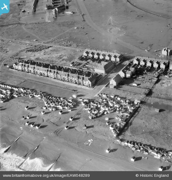
EAW048289 ENGLAND (1953). Storm damaged beach huts on the beach near Manor Road, Felixstowe, 1953
© Copyright OpenStreetMap contributors and licensed by the OpenStreetMap Foundation. 2026. Cartography is licensed as CC BY-SA.
Nearby Images (3)
EAW048289

EAW048295

EAW048294

Details
| Title | [EAW048289] Storm damaged beach huts on the beach near Manor Road, Felixstowe, 1953 |
| Reference | EAW048289 |
| Date | 2-February-1953 |
| Link | |
| Place name | FELIXSTOWE |
| Parish | FELIXSTOWE |
| District | |
| Country | ENGLAND |
| Easting / Northing | 629197, 232970 |
| Longitude / Latitude | 1.335476011064, 51.947490810505 |
| National Grid Reference | TM292330 |
Pins
User Comment Contributions
Type 22 and Suffolk Square Felixstowe |

cptpies |
Tuesday 10th of March 2015 12:41:03 PM |