
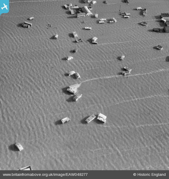
EAW048277 ENGLAND (1953). Flooded caravan camp near The Monk's Head Pub, Seawick, 1953
© Copyright OpenStreetMap contributors and licensed by the OpenStreetMap Foundation. 2026. Cartography is licensed as CC BY-SA.
Nearby Images (3)
EAW048277

EAW048279

EAW048273

Details
| Title | [EAW048277] Flooded caravan camp near The Monk's Head Pub, Seawick, 1953 |
| Reference | EAW048277 |
| Date | 2-February-1953 |
| Link | |
| Place name | SEAWICK |
| Parish | ST. OSYTH |
| District | |
| Country | ENGLAND |
| Easting / Northing | 612864, 213164 |
| Longitude / Latitude | 1.0859686441473, 51.776145641363 |
| National Grid Reference | TM129132 |
Pins

Billy Turner |
Friday 18th of December 2015 10:52:02 PM | |
|
Billy Turner |
Friday 18th of December 2015 10:28:44 PM |

