
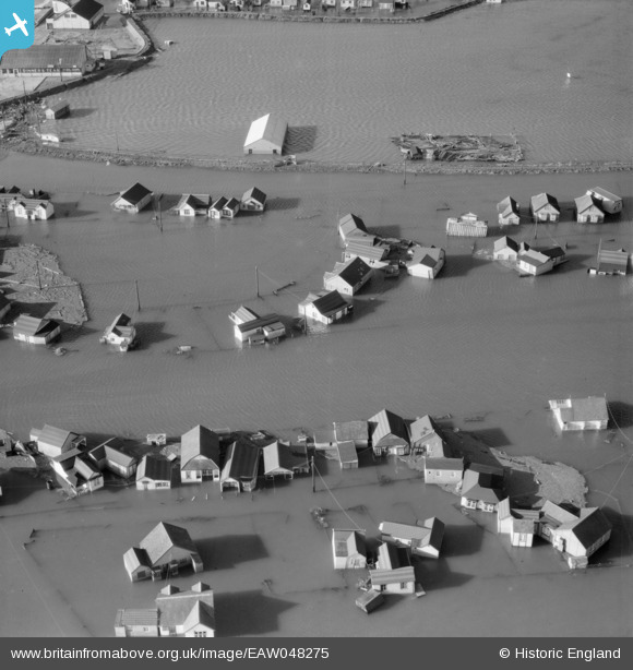
EAW048275 ENGLAND (1953). Flooding at Sea Way, Sea Crescent and Lake Way, Jaywick, 1953
© Copyright OpenStreetMap contributors and licensed by the OpenStreetMap Foundation. 2026. Cartography is licensed as CC BY-SA.
Nearby Images (4)
EAW048275

EAW048274

EAW048265

EAW048263

Details
| Title | [EAW048275] Flooding at Sea Way, Sea Crescent and Lake Way, Jaywick, 1953 |
| Reference | EAW048275 |
| Date | 2-March-1953 |
| Link | |
| Place name | JAYWICK |
| Parish | |
| District | |
| Country | ENGLAND |
| Easting / Northing | 614784, 212977 |
| Longitude / Latitude | 1.1136437990568, 51.773733158284 |
| National Grid Reference | TM148130 |
Pins
Be the first to add a comment to this image!