
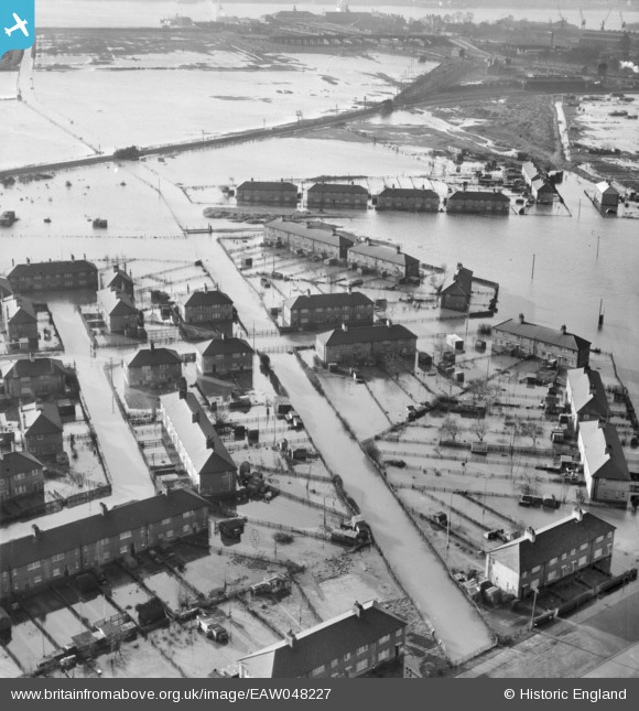
EAW048227 ENGLAND (1953). Flooding around Moore Avenue, Tilbury, 1953
© Copyright OpenStreetMap contributors and licensed by the OpenStreetMap Foundation. 2026. Cartography is licensed as CC BY-SA.
Nearby Images (3)
EAW048227

EAW048230

EAW048228

Details
| Title | [EAW048227] Flooding around Moore Avenue, Tilbury, 1953 |
| Reference | EAW048227 |
| Date | 2-February-1953 |
| Link | |
| Place name | TILBURY |
| Parish | |
| District | |
| Country | ENGLAND |
| Easting / Northing | 564808, 176282 |
| Longitude / Latitude | 0.372673640819, 51.460996296369 |
| National Grid Reference | TQ648763 |
Pins
Be the first to add a comment to this image!