
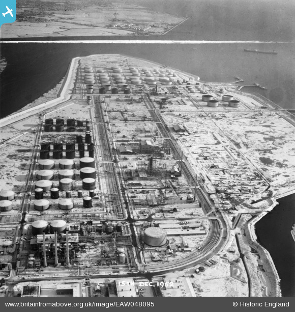
EAW048095 ENGLAND (1952). Coryton Oil Refinery, Coryton, from the west, 1952. This image was marked by Aerofilms Ltd for photo editing.
© Copyright OpenStreetMap contributors and licensed by the OpenStreetMap Foundation. 2026. Cartography is licensed as CC BY-SA.
Nearby Images (48)
EAW043886

EAW039884

EAW034435

EAW035778

EAW042272

EAW051371

EAW035772

EAW048097

EAW043887

EAW034437

EAW045730

EAW048372

EAW043880

EAW047438

EAW042285

EAW048594

EAW048086

EAW039894

EAW042274

EAW047421

EAW035783

EAW034404

EAW043885

EAW035775

EAW024609
, Coryton, from the east, 1949. This image has been produced from a damaged negative.")
EAW048103

EAW034440

EAW048094

EAW042276

EAW035776

EAW034438

EAW048600

EAW034439

EAW053085

EAW042273

EAW047436

EAW048104

EAW051373

EAW048373

EAW045729

EAW045731

EAW048367

EAW047427

EAW048375

EAW048105

EAW051372

EAW045722

EAW045726

Details
| Title | [EAW048095] Coryton Oil Refinery, Coryton, from the west, 1952. This image was marked by Aerofilms Ltd for photo editing. |
| Reference | EAW048095 |
| Date | 15-December-1952 |
| Link | |
| Place name | CORYTON |
| Parish | |
| District | |
| Country | ENGLAND |
| Easting / Northing | 574903, 182228 |
| Longitude / Latitude | 0.52080621459081, 51.511384708891 |
| National Grid Reference | TQ749822 |
Pins
Be the first to add a comment to this image!