
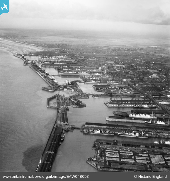
EAW048053 ENGLAND (1952). The Port of Liverpool from Huskisson Dock to Gladstone Dock, Sandhills, from the south, 1952
© Copyright OpenStreetMap contributors and licensed by the OpenStreetMap Foundation. 2026. Cartography is licensed as CC BY-SA.
Nearby Images (7)
EAW048053

EAW023372

EAW001704

EAW048051

EAW023371

EPW005046

EPW023590

Details
| Title | [EAW048053] The Port of Liverpool from Huskisson Dock to Gladstone Dock, Sandhills, from the south, 1952 |
| Reference | EAW048053 |
| Date | 12-December-1952 |
| Link | |
| Place name | SANDHILLS |
| Parish | |
| District | |
| Country | ENGLAND |
| Easting / Northing | 333332, 393419 |
| Longitude / Latitude | -3.0035897278518, 53.433076184616 |
| National Grid Reference | SJ333934 |
Pins
Be the first to add a comment to this image!