
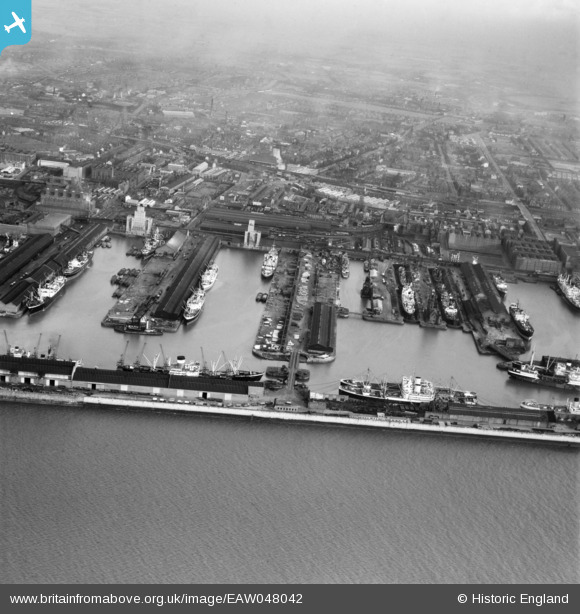
EAW048042 ENGLAND (1952). Alexandra Dock and Langton Dock, Bootle, from the south-west, 1952
© Copyright OpenStreetMap contributors and licensed by the OpenStreetMap Foundation. 2026. Cartography is licensed as CC BY-SA.
Nearby Images (2)
EAW048042

EAW133870

Details
| Title | [EAW048042] Alexandra Dock and Langton Dock, Bootle, from the south-west, 1952 |
| Reference | EAW048042 |
| Date | 12-December-1952 |
| Link | |
| Place name | BOOTLE |
| Parish | |
| District | |
| Country | ENGLAND |
| Easting / Northing | 332808, 394658 |
| Longitude / Latitude | -3.0117409634346, 53.444145979582 |
| National Grid Reference | SJ328947 |
Pins
Be the first to add a comment to this image!