
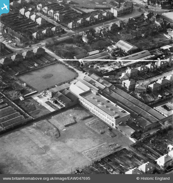
EAW047695 ENGLAND (1952). The Marryat and Scott Ltd Wellington Works, Hounslow, 1952. This image was marked by Aerofilms Ltd for photo editing.
© Copyright OpenStreetMap contributors and licensed by the OpenStreetMap Foundation. 2026. Cartography is licensed as CC BY-SA.
Nearby Images (10)
EAW047695

EAW047694

EAW047696

EAW047701

EAW047697

EAW047702

EAW047693

EAW047700

EAW047698

EAW047699

Details
| Title | [EAW047695] The Marryat and Scott Ltd Wellington Works, Hounslow, 1952. This image was marked by Aerofilms Ltd for photo editing. |
| Reference | EAW047695 |
| Date | 7-November-1952 |
| Link | |
| Place name | HOUNSLOW |
| Parish | |
| District | |
| Country | ENGLAND |
| Easting / Northing | 512961, 175130 |
| Longitude / Latitude | -0.37371716372213, 51.463367500504 |
| National Grid Reference | TQ130751 |
Pins

redmist |
Tuesday 16th of November 2021 04:46:12 PM | |
|
Nowy Paul |
Sunday 29th of October 2017 02:49:29 PM |