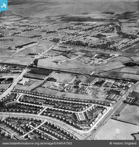
EAW047302 ENGLAND (1952). Speke Industrial Estate and environs, Speke, 1952
© Copyright OpenStreetMap contributors and licensed by the OpenStreetMap Foundation. 2026. Cartography is licensed as CC BY-SA.
Nearby Images (11)
Details
| Title | [EAW047302] Speke Industrial Estate and environs, Speke, 1952 |
| Reference | EAW047302 |
| Date | 4-October-1952 |
| Link | |
| Place name | SPEKE |
| Parish | |
| District | |
| Country | ENGLAND |
| Easting / Northing | 343035, 384380 |
| Longitude / Latitude | -2.8559129785798, 53.352965857868 |
| National Grid Reference | SJ430844 |
Pins

Hamilton163 |
Thursday 15th of December 2022 06:02:12 PM | |

Hamilton163 |
Thursday 15th of December 2022 06:02:12 PM | |

Hamilton163 |
Thursday 15th of December 2022 05:59:48 PM | |

Hamilton163 |
Thursday 15th of December 2022 05:59:48 PM | |

Hamilton163 |
Thursday 15th of December 2022 05:57:21 PM | |

John Wass |
Saturday 9th of May 2015 12:12:57 PM |


![[EAW047302] Speke Industrial Estate and environs, Speke, 1952](http://britainfromabove.org.uk/sites/all/libraries/aerofilms-images/public/100x100/EAW/047/EAW047302.jpg)
![[EPW057874] Works off Speke Hall Road, the Warrington and Garston Railway Line Railway Line and environs, Speke, 1938](http://britainfromabove.org.uk/sites/all/libraries/aerofilms-images/public/100x100/EPW/057/EPW057874.jpg)
![[EAW047301] Speke Industrial Estate and environs, Speke, 1952](http://britainfromabove.org.uk/sites/all/libraries/aerofilms-images/public/100x100/EAW/047/EAW047301.jpg)
![[EAW004067] Milners Safe Co Ltd Phoenix Works at Hunt's Cross, Speke, 1947. This image was marked by Aerofilms Ltd for photo editing.](http://britainfromabove.org.uk/sites/all/libraries/aerofilms-images/public/100x100/EAW/004/EAW004067.jpg)
![[EAW004075] Milners Safe Co Ltd Phoenix Works at Hunt's Cross, Speke, 1947](http://britainfromabove.org.uk/sites/all/libraries/aerofilms-images/public/100x100/EAW/004/EAW004075.jpg)
![[EAW004071] Milners Safe Co Ltd Phoenix Works at Hunt's Cross, Speke, 1947. This image was marked by Aerofilms Ltd for photo editing.](http://britainfromabove.org.uk/sites/all/libraries/aerofilms-images/public/100x100/EAW/004/EAW004071.jpg)
![[EAW004077] Milners Safe Co Ltd Phoenix Works at Hunt's Cross, Speke, 1947](http://britainfromabove.org.uk/sites/all/libraries/aerofilms-images/public/100x100/EAW/004/EAW004077.jpg)
![[EAW004076] Milners Safe Co Ltd Phoenix Works at Hunt's Cross, Speke, 1947](http://britainfromabove.org.uk/sites/all/libraries/aerofilms-images/public/100x100/EAW/004/EAW004076.jpg)
![[EPW057889] The Garston and Runcorn Gap Railway Line and environs, Hunt's Cross, 1938. This image has been produced from a damaged copy-negative.](http://britainfromabove.org.uk/sites/all/libraries/aerofilms-images/public/100x100/EPW/057/EPW057889.jpg)
![[EAW004070] Milners Safe Co Ltd Phoenix Works at Hunt's Cross, Speke, 1947. This image was marked by Aerofilms Ltd for photo editing.](http://britainfromabove.org.uk/sites/all/libraries/aerofilms-images/public/100x100/EAW/004/EAW004070.jpg)
![[EAW004068] Milners Safe Co Ltd Phoenix Works at Hunt's Cross, Speke, 1947. This image was marked by Aerofilms Ltd for photo editing.](http://britainfromabove.org.uk/sites/all/libraries/aerofilms-images/public/100x100/EAW/004/EAW004068.jpg)