
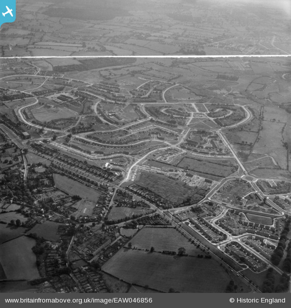
EAW046856 ENGLAND (1952). The residential area at Shard End under construction, Birmingham, 1952. This image was marked by Aerofilms Ltd for photo editing.
© Copyright OpenStreetMap contributors and licensed by the OpenStreetMap Foundation. 2026. Cartography is licensed as CC BY-SA.
Nearby Images (3)
EAW046856

EAW046854

EAW046853

Details
| Title | [EAW046856] The residential area at Shard End under construction, Birmingham, 1952. This image was marked by Aerofilms Ltd for photo editing. |
| Reference | EAW046856 |
| Date | 18-September-1952 |
| Link | |
| Place name | BIRMINGHAM |
| Parish | |
| District | |
| Country | ENGLAND |
| Easting / Northing | 415243, 288993 |
| Longitude / Latitude | -1.7754392177532, 52.498261338149 |
| National Grid Reference | SP152890 |
Pins

Michael_K |
Friday 22nd of May 2020 04:57:19 PM |