
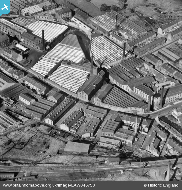
EAW046750 ENGLAND (1952). Primet Cotton Mill, Bridge Shed Cotton Mill and environs, Colne, 1952
© Copyright OpenStreetMap contributors and licensed by the OpenStreetMap Foundation. 2026. Cartography is licensed as CC BY-SA.
Nearby Images (11)
EAW046750

EAW046751

EAW046749

EAW046755

EAW046748

EAW046747

EAW046746

EAW046754

EAW046753

EAW046756

EAW046752

Details
| Title | [EAW046750] Primet Cotton Mill, Bridge Shed Cotton Mill and environs, Colne, 1952 |
| Reference | EAW046750 |
| Date | 12-September-1952 |
| Link | |
| Place name | COLNE |
| Parish | COLNE |
| District | |
| Country | ENGLAND |
| Easting / Northing | 388001, 439581 |
| Longitude / Latitude | -2.1824241831252, 53.852114810751 |
| National Grid Reference | SD880396 |
Pins

J May |
Monday 6th of August 2018 08:55:17 PM |
User Comment Contributions
Railway line across the bottom, Burnley to the left |
wadey |
Friday 12th of September 2014 03:58:47 PM |