
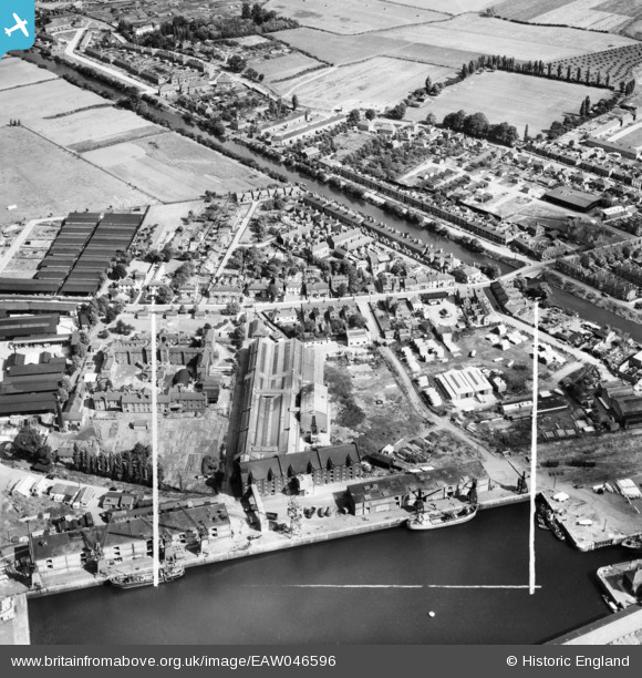
EAW046596 ENGLAND (1952). The Fisons Ltd Fertilizer Works and environs, Boston, 1952. This image was marked by Aerofilms Ltd for photo editing.
© Copyright OpenStreetMap contributors and licensed by the OpenStreetMap Foundation. 2026. Cartography is licensed as CC BY-SA.
Nearby Images (8)
EAW046596

EAW046595

EAW046597

EAW046594

EAW046599

EAW046593

EAW046592

EPW031904

Details
| Title | [EAW046596] The Fisons Ltd Fertilizer Works and environs, Boston, 1952. This image was marked by Aerofilms Ltd for photo editing. |
| Reference | EAW046596 |
| Date | 1-September-1952 |
| Link | |
| Place name | BOSTON |
| Parish | |
| District | |
| Country | ENGLAND |
| Easting / Northing | 533336, 343316 |
| Longitude / Latitude | -0.014246172040947, 52.970285044324 |
| National Grid Reference | TF333433 |
Pins

Matt Aldred edob.mattaldred.com |
Sunday 16th of May 2021 09:41:16 PM | |
|
Matt Aldred edob.mattaldred.com |
Monday 22nd of February 2021 07:46:30 PM | |

redmist |
Thursday 14th of November 2019 10:30:23 AM | |
|
redmist |
Thursday 26th of September 2019 12:22:01 PM | |
|
redmist |
Thursday 26th of September 2019 12:21:22 PM | |
|
redmist |
Thursday 26th of September 2019 12:20:32 PM | |
|
redmist |
Thursday 26th of September 2019 12:19:42 PM |