
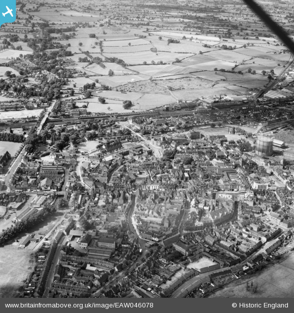
EAW046078 ENGLAND (1952). The town centre, Stafford, 1952
© Copyright OpenStreetMap contributors and licensed by the OpenStreetMap Foundation. 2026. Cartography is licensed as CC BY-SA.
Nearby Images (13)
EAW046078

EAW024957

EPW034022

EPW053375

EAW024956

EAW001865

EPW014109

EAW024955

EAW001866

EAW024958

EPW053381

EPW014106

EPW053380

Details
| Title | [EAW046078] The town centre, Stafford, 1952 |
| Reference | EAW046078 |
| Date | 25-August-1952 |
| Link | |
| Place name | STAFFORD |
| Parish | |
| District | |
| Country | ENGLAND |
| Easting / Northing | 392013, 323105 |
| Longitude / Latitude | -2.1184915101783, 52.805107591482 |
| National Grid Reference | SJ920231 |
Pins

AJ |
Saturday 2nd of October 2021 11:25:11 AM | |
|
AJ |
Saturday 2nd of October 2021 11:20:47 AM | |
|
AJ |
Saturday 2nd of October 2021 11:18:27 AM | |
|
AJ |
Saturday 2nd of October 2021 11:15:35 AM | |
|
Phil Bradshaw |
Tuesday 15th of October 2019 10:08:34 PM | |
|
Phil Bradshaw |
Tuesday 15th of October 2019 09:50:40 PM | |
|
Phil Bradshaw |
Wednesday 31st of October 2018 08:29:08 PM | |
|
Phil Bradshaw |
Wednesday 31st of October 2018 08:28:36 PM | |
|
Phil Bradshaw |
Wednesday 31st of October 2018 08:27:07 PM | |
|
Phil Bradshaw |
Wednesday 31st of October 2018 08:26:00 PM | |
|
Dobbo |
Tuesday 24th of June 2014 09:13:02 PM |

