
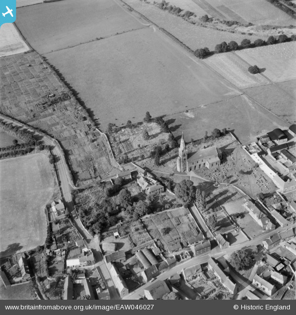
EAW046027 ENGLAND (1952). All Saints' Church, Brixworth, 1952
© Copyright OpenStreetMap contributors and licensed by the OpenStreetMap Foundation. 2026. Cartography is licensed as CC BY-SA.
Nearby Images (6)
EAW046027

EAW046026

EAW046028

EAW046024

EAW046025

EAW046029

Details
| Title | [EAW046027] All Saints' Church, Brixworth, 1952 |
| Reference | EAW046027 |
| Date | 22-August-1952 |
| Link | |
| Place name | BRIXWORTH |
| Parish | BRIXWORTH |
| District | |
| Country | ENGLAND |
| Easting / Northing | 474706, 271249 |
| Longitude / Latitude | -0.90349610067039, 52.333848243769 |
| National Grid Reference | SP747712 |
Pins
Be the first to add a comment to this image!