
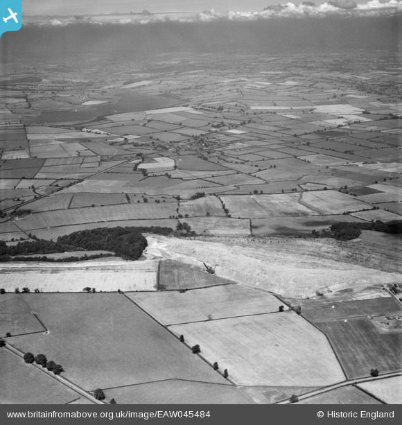
EAW045484 ENGLAND (1952). Quarrying alongside The Cow Pasture and the surrounding countryside, Rockingham, from the south-east, 1952
© Copyright OpenStreetMap contributors and licensed by the OpenStreetMap Foundation. 2026. Cartography is licensed as CC BY-SA.
Nearby Images (2)
EAW045484

EAW044679

Details
| Title | [EAW045484] Quarrying alongside The Cow Pasture and the surrounding countryside, Rockingham, from the south-east, 1952 |
| Reference | EAW045484 |
| Date | 6-August-1952 |
| Link | |
| Place name | ROCKINGHAM |
| Parish | ROCKINGHAM |
| District | |
| Country | ENGLAND |
| Easting / Northing | 487747, 291300 |
| Longitude / Latitude | -0.70687091691794, 52.512151808466 |
| National Grid Reference | SP877913 |
Pins

Matt Aldred edob.mattaldred.com |
Tuesday 22nd of February 2022 07:50:17 PM |