
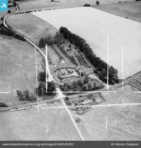
EAW045282 ENGLAND (1952). Hinchwick Manor, Hinchwick, 1952. This image was marked by Aerofilms Ltd for photo editing.
© Copyright OpenStreetMap contributors and licensed by the OpenStreetMap Foundation. 2026. Cartography is licensed as CC BY-SA.
Nearby Images (5)
EAW045282

EAW045280

EAW045279

EAW045281

EAW045283

Details
| Title | [EAW045282] Hinchwick Manor, Hinchwick, 1952. This image was marked by Aerofilms Ltd for photo editing. |
| Reference | EAW045282 |
| Date | 30-July-1952 |
| Link | |
| Place name | HINCHWICK |
| Parish | CONDICOTE |
| District | |
| Country | ENGLAND |
| Easting / Northing | 414479, 229987 |
| Longitude / Latitude | -1.789222355313, 51.967740165455 |
| National Grid Reference | SP145300 |
Pins
Be the first to add a comment to this image!