
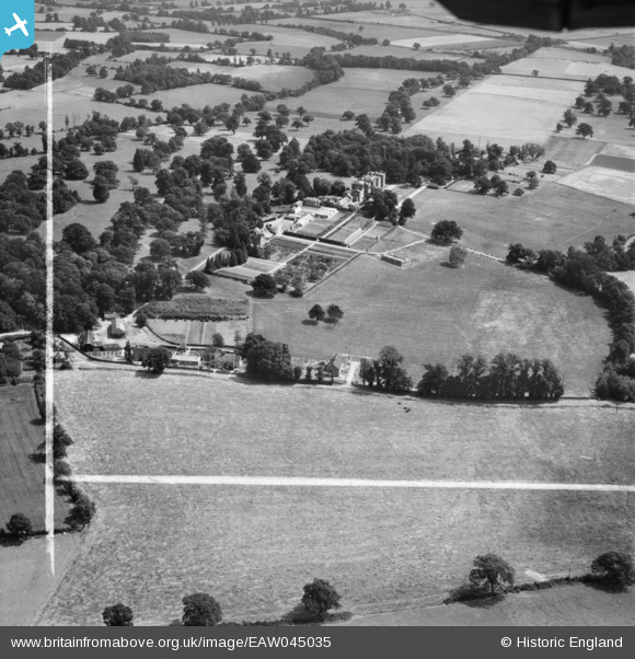
EAW045035 ENGLAND (1952). St Benedict's School, Wokefield Park, 1952. This image was marked by Aerofilms Ltd for photo editing.
© Copyright OpenStreetMap contributors and licensed by the OpenStreetMap Foundation. 2025. Cartography is licensed as CC BY-SA.
Nearby Images (3)
EAW045035

EAW045033

EAW045038

Details
| Title | [EAW045035] St Benedict's School, Wokefield Park, 1952. This image was marked by Aerofilms Ltd for photo editing. |
| Reference | EAW045035 |
| Date | 26-July-1952 |
| Link | |
| Place name | WOKEFIELD PARK |
| Parish | WOKEFIELD |
| District | |
| Country | ENGLAND |
| Easting / Northing | 467023, 165638 |
| Longitude / Latitude | -1.0367406846639, 51.38532869769 |
| National Grid Reference | SU670656 |
Pins
Be the first to add a comment to this image!