
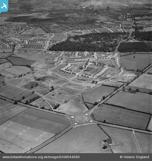
EAW044690 ENGLAND (1952). The Lodge Park Estate under construction, Corby, 1952
© Copyright OpenStreetMap contributors and licensed by the OpenStreetMap Foundation. 2025. Cartography is licensed as CC BY-SA.
Nearby Images (7)
EAW044690

EAW044691

EAW044692

EAW045569

EAW044684

EAW044688

EAW045431

Details
| Title | [EAW044690] The Lodge Park Estate under construction, Corby, 1952 |
| Reference | EAW044690 |
| Date | 22-July-1952 |
| Link | |
| Place name | CORBY |
| Parish | |
| District | |
| Country | ENGLAND |
| Easting / Northing | 486734, 289314 |
| Longitude / Latitude | -0.72231321969284, 52.494462335642 |
| National Grid Reference | SP867893 |
Pins
Be the first to add a comment to this image!